By Kaala B. Moombe
The COLANDS Zambia team has, in recent months, been conducting field monitoring and assessments while at the same time, collaborating with partners, including participation in workshops, contributing to development plans, and facilitating discussions and education sessions.
A cross-sectional workshop on the roles and responsibilities of stakeholders was organized by the Zambia Community Based Natural Resources Management Forum (CBNRMF) in October 2022. COLANDS activities were also publicized in the CBNRMF Annual Bulletin.
In the final months of 2022, the COLANDS team also:
- as part of CIFOR-ICRAF, participated in the eighth national development plan/cluster implementation plan under the Cluster Advisory Group (COLANDS activities have been reflected in the provincial forest sector plan);
- facilitated a side session on governance of Community Forest Management Groups during the Community Forest Management Conference in Lusaka in October 2022 that included community members, chiefs, and representatives of NGOs; COLANDS activities were also presented during the conference.
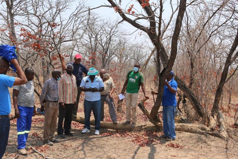
In October and November 2022, COLANDS conducted biodiversity assessments of vegetation and birds, and carried out soil surveys in several clusters of village landscapes:
- the Mudenda cluster of four village landscapes in Nkandanzovu, Chikanta Chiefdom, Kalomo District;
- 22 village landscapes in the Siabalumbi cluster and four in the Mantanyani cluster, both located in Sipatunyana Chiefdom, Kalomo District;
- 12 village landscapes in the Bbilili cluster in Siachitema Chiefdom, Kalomo District;
- in total, the CIFOR-ICRAF team interacted with 797 community members, almost 53 percent of those female.
Planning meetings were held in the same period, to review and reflect on the year’s activities and to plan for meetings in early 2023 with the Ministry of Local Government and Rural Development, Kalomo District Council; and with the Provincial Forestry Officer for an extraordinary provincial development coordination committee to review project progress and the way forward. Additional meetings were also organized with the ZCBNRMF to review the buy-in activities.
Participatory mapping validation was conducted in December 2022 in the Mantanyani, Mudenda and Siabalumbi village clusters. As well, interviews were organized to collect material in Mantanyani and Siabalumbi clusters, including interviews with Chief Chikanta, headmen from Mantanyani and Mudenda, and community members, on such topics as validation of participatory maps and biodiversity assessments for Zambia News and Information Services (ZANIS) television programmes. These will be broadcast as part of the Ministry of Green Economy and Environment television series for Zambia’s Southern Province.
The participatory mapping validation work followed two capacity-building workshops organized by the COLANDS team in Zambia between April and August 2022. Participatory mapping is an excellent tool for unravelling stakeholder perspectives of landscape dynamics and trade-offs, which are essential to understand when implementing integrated landscape approaches (ILA).
Other media and outreach activities in the period include publication of a news item by ZANIS related to COLANDS work on the biodiversity assessments. During those assessments, interviews were recorded for upcoming editions of the Voice of Kalomo radio programme.
Private-sector entities versus customary landscape models
During December 2022, COLANDS Zambia held on-farm discussions with commercial farmers and private-sector entities concerning their perspectives on ILAs and comparisons of the private commercial farm model vs customary landscape management models. Discussions added to knowledge and perspectives on ILAs and potential engagement with the COLANDS project. The COLANDS team agreed to organize a televised interview with ZANIS to talk about perspectives and historical dimensions of land use planning and the ‘de-evolution’ of the governance systems, tools and platforms.
COLANDS was invited to conduct biodiversity assessments on two permanent sample plots, of 100 ha and 200 ha, which the commercial farmers had established some 25 years ago.
As of early 2023, COLANDS has been collecting data to support modelling above-ground and below-ground tree biomass and carbon stock estimation in the Mantanyani and Bbilili villages cluster located in the dry Miombo Mopane woodlands of Kalomo District, Southern Province.