


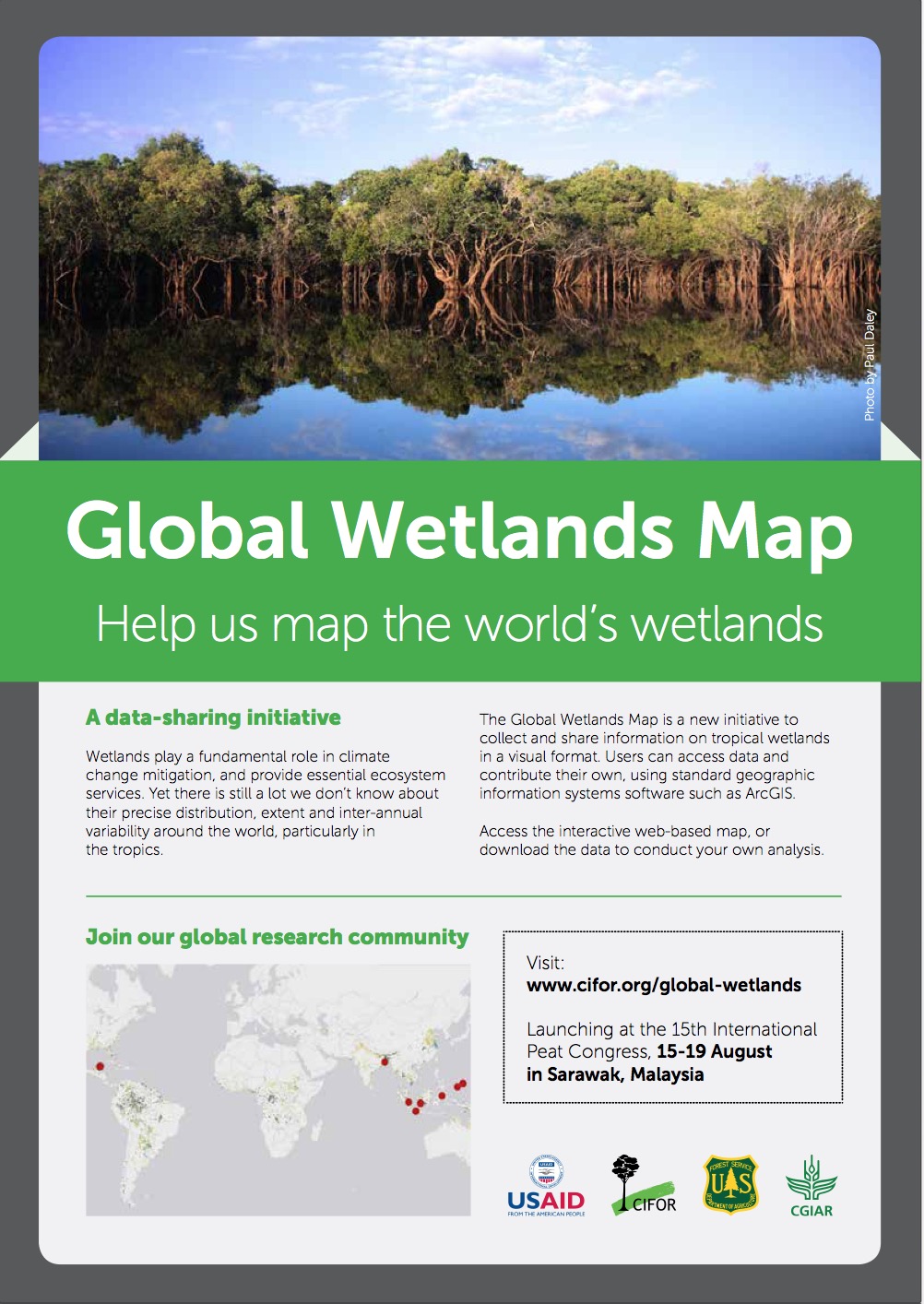
The Global Wetlands Map covers the tropics and subtropics regions (40° N to 60° S; 180° E to -180° W), excluding small islands. This mapping is a hydro-geomorphological model based on an Expert System approach to estimate wetland areas, which relies on three biophysical indices related to wetland and peat formation: (1) long-term water supply exceeding atmospheric water demand; (2) annually or seasonally waterlogged soils; and (3) a geomorphological position where water is supplied and retained (Gumbricht et al. 2017).
Export citation:
RIS (.ris)
TI  - The Global Wetlands Map
AU  - SWAMP Projects
AB  - The Global Wetlands Map covers the tropics and subtropics regions (40° N to 60° S; 180° E to -180° W), excluding small islands. This mapping is a hydro-geomorphological model based on an Expert System approach to estimate wetland areas, which relies on three biophysical indices related to wetland and peat formation: (1) long-term water supply exceeding atmospheric water demand; (2) annually or seasonally waterlogged soils; and (3) a geomorphological position where water is supplied and retained (Gumbricht et al. 2017).
PY  - 2017
PB  - CIFOR and USFS
UR  - https://www.cifor-icraf.org/knowledge/publication/7d5e8b95-136e-4c25-aaaf-482753cc0dfe/
KW  - maps, wetlands
ER  -
Endnote (.ciw)
%T The Global Wetlands Map
%A SWAMP Projects
%D 2017
%I CIFOR and USFS
%U https://www.cifor-icraf.org/knowledge/publication/7d5e8b95-136e-4c25-aaaf-482753cc0dfe/
%X The Global Wetlands Map covers the tropics and subtropics regions (40° N to 60° S; 180° E to -180° W), excluding small islands. This mapping is a hydro-geomorphological model based on an Expert System approach to estimate wetland areas, which relies on three biophysical indices related to wetland and peat formation: (1) long-term water supply exceeding atmospheric water demand; (2) annually or seasonally waterlogged soils; and (3) a geomorphological position where water is supplied and retained (Gumbricht et al. 2017).
%K maps
%K wetlands
Publisher
CIFOR and USFS
Publication year
2017
Authors
Language
English
Keywords
maps, wetlands


